Ground Truthing and Virtual Field Trips

iLRN 2020 Workshop

About

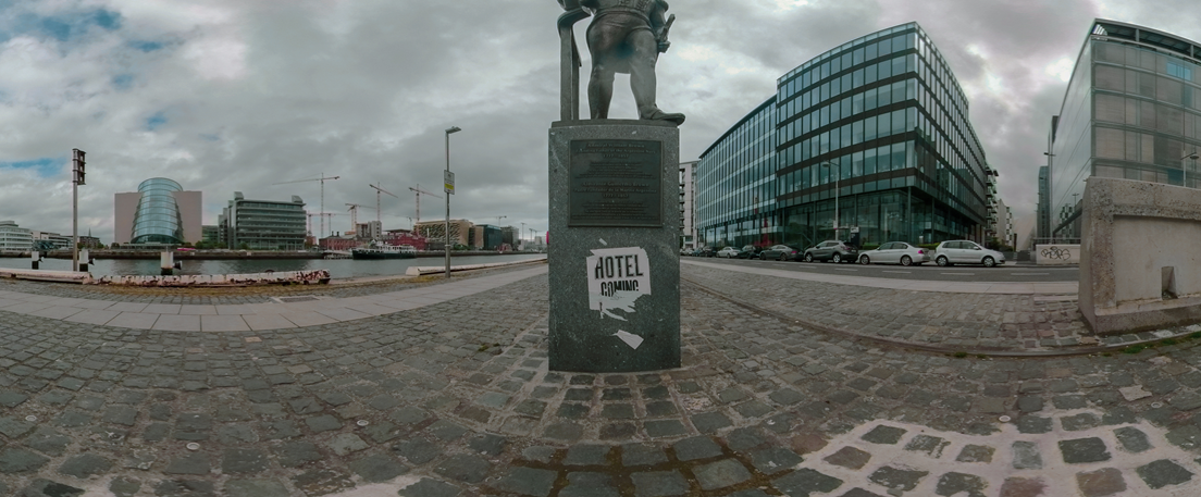
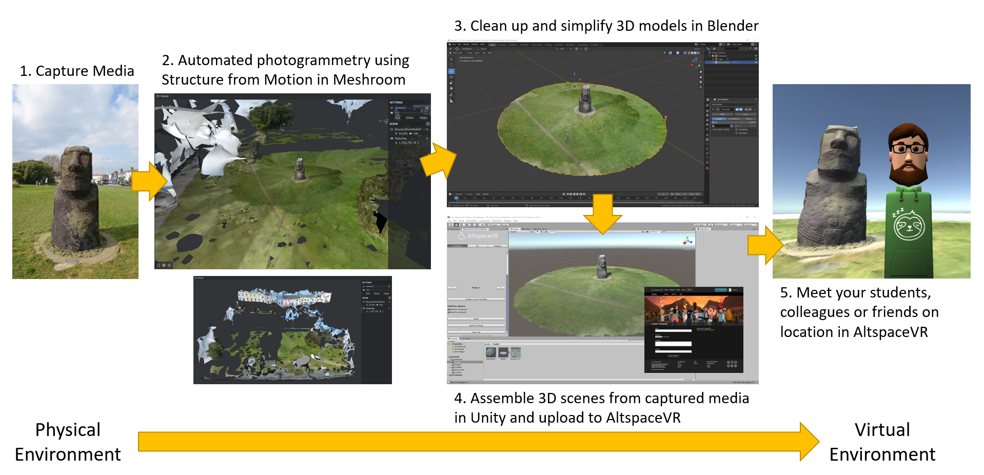
This workshop will provide iLRN 2020 delegates with an opportunity to extend their knowledge of shared immersive virtual environments (IVEs) in the context of teaching and learning through co-creation. The workshop will begin by outlining methods for capturing digital media in-situ, establishing the 'ground truth' of a place as both as teaching preparation and as a learning activity in its own right.

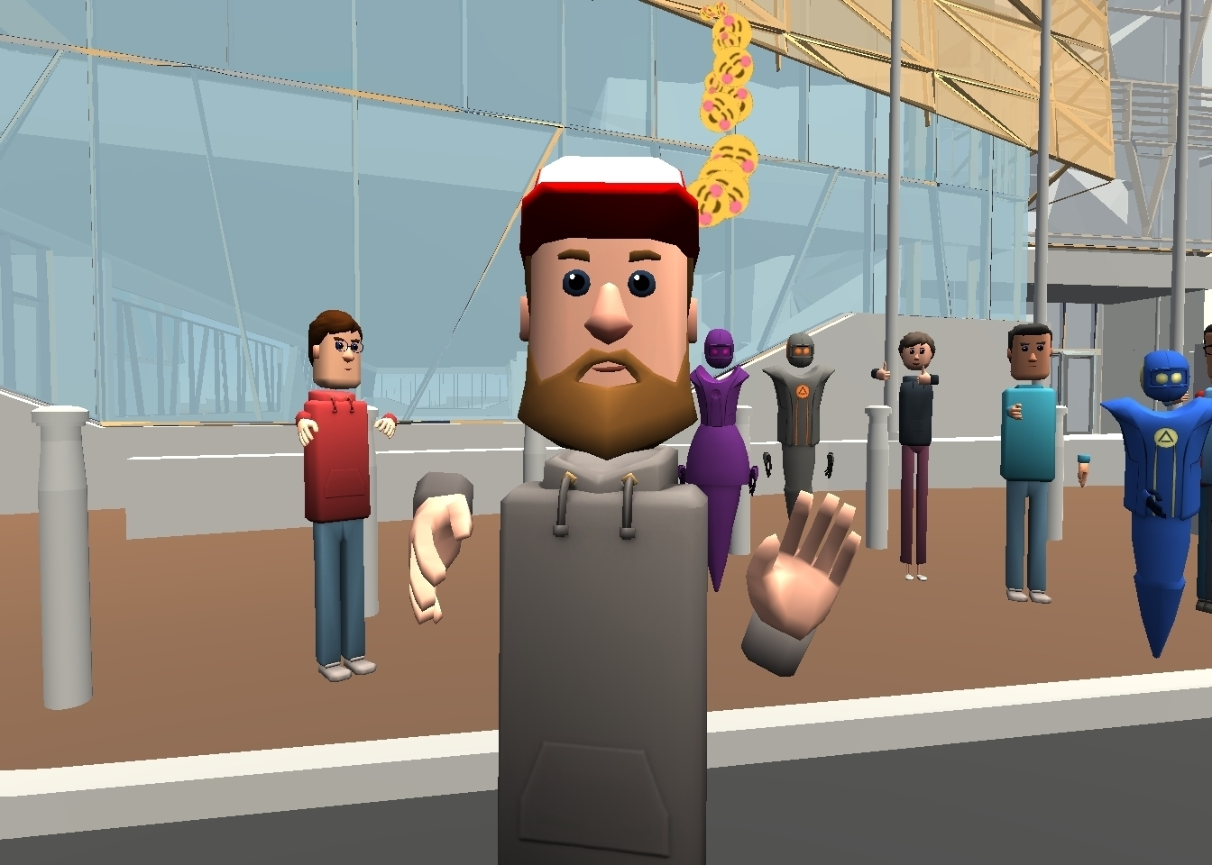
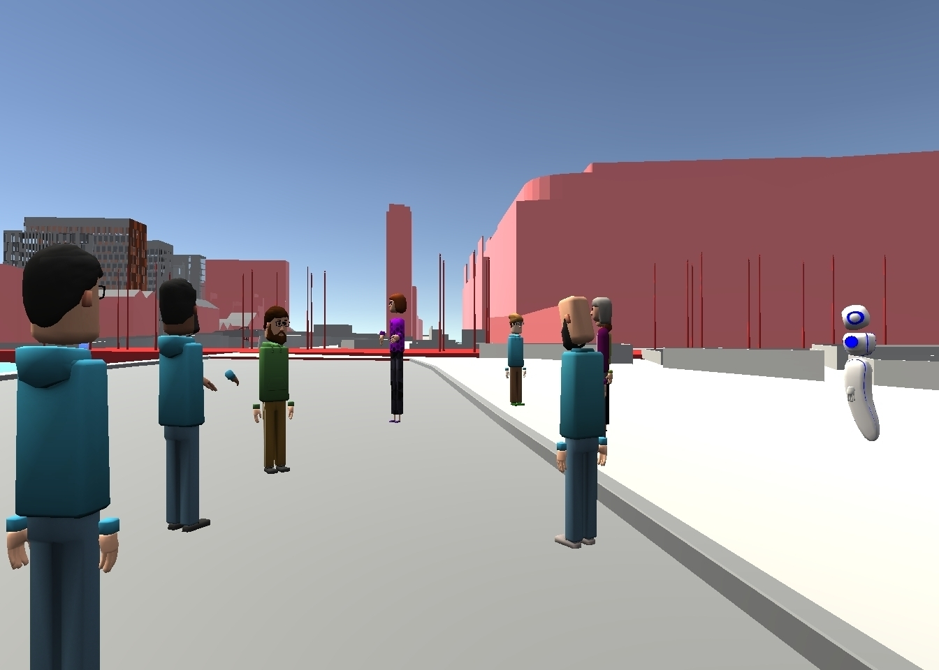
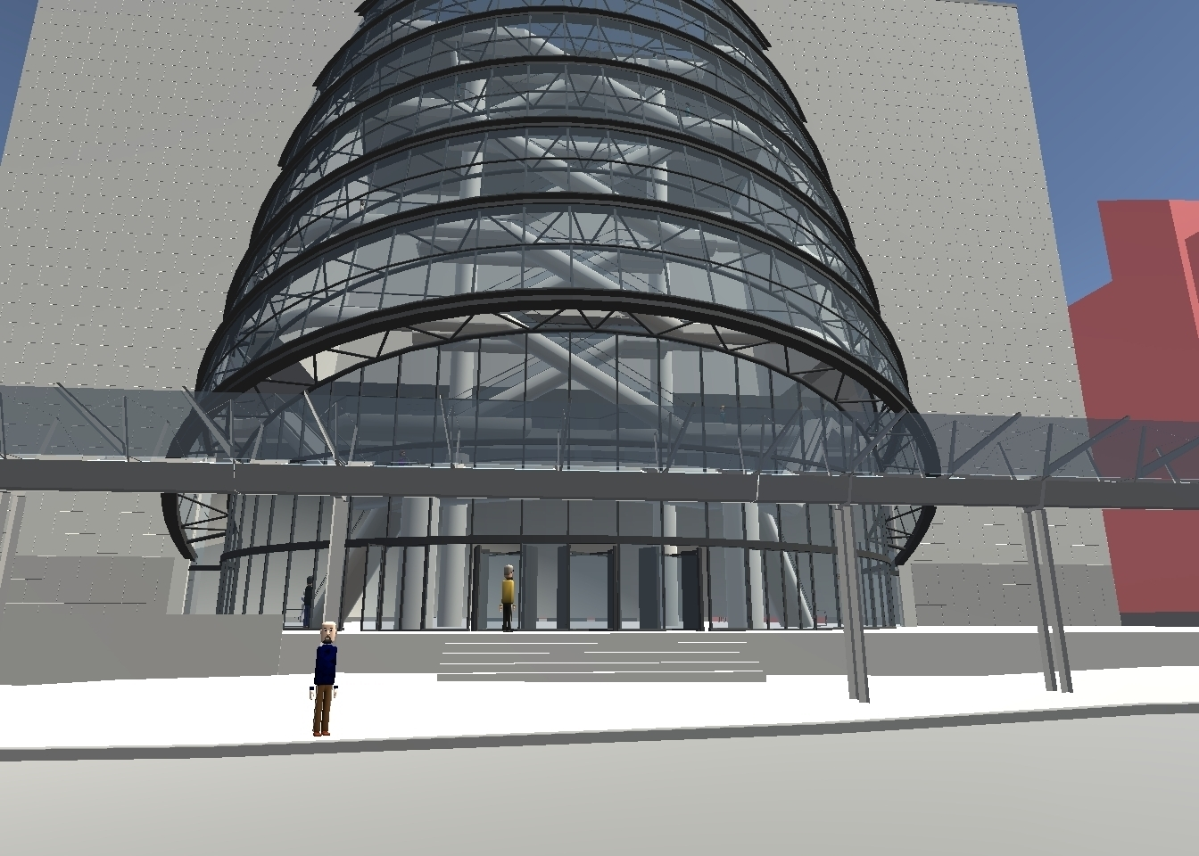
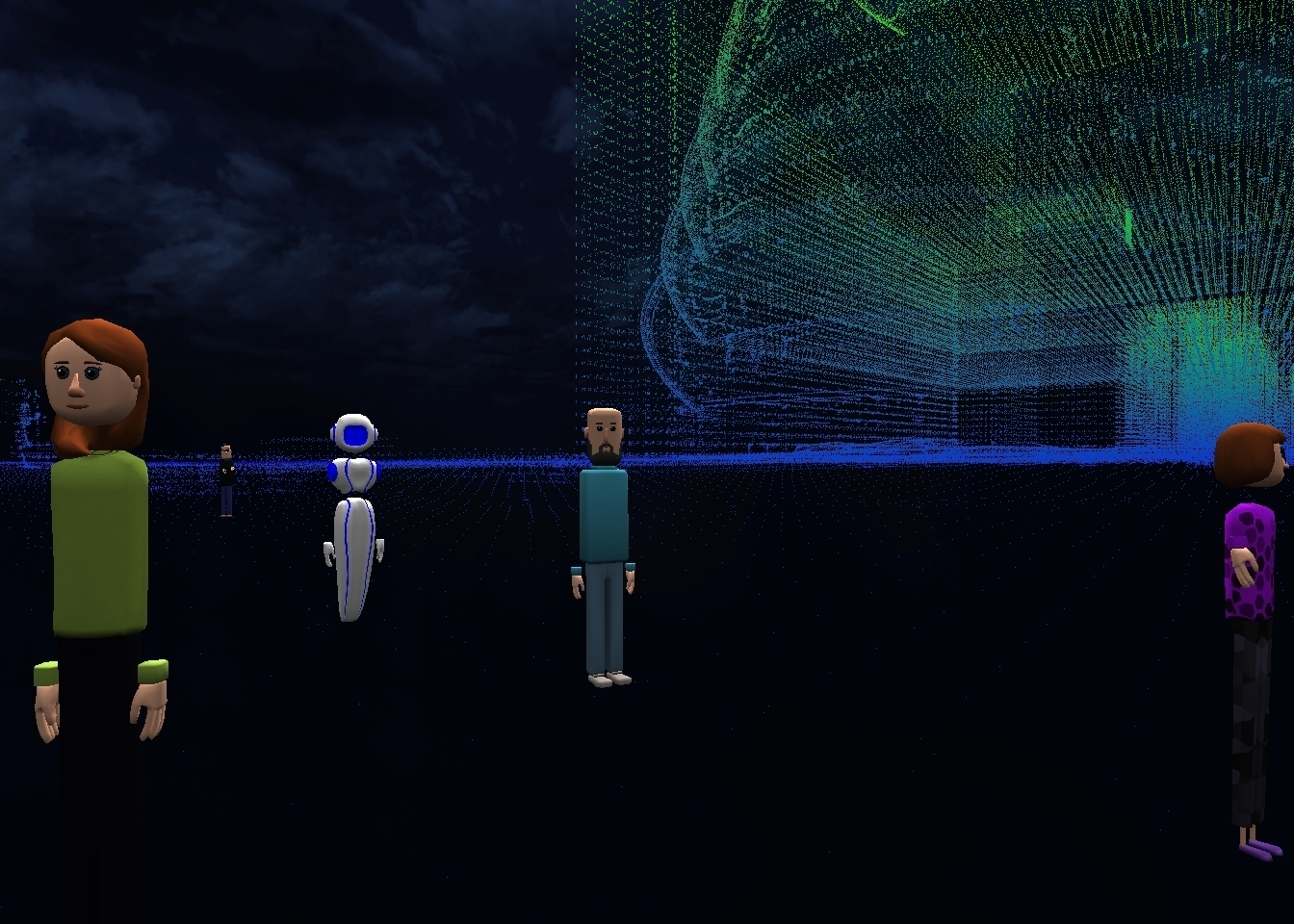
The workshop will then demonstrate how data captured in physical locations can be incorporated into online 3D models that can be experienced via social virtual reality (VR) as a 'virtual field trip'. This activity highlights the active and constitutive role of the student in the selection and capture of data representing their environment, and its value as a means for encouraging active learning through imaginative engagement with the creation of IVEs.

Workshop participants will be taken on a virtual expedition into one such model to stimulate further discussion about how these environments can be used to promote active learning. While the session focuses on the use of captured media to establish the ground truth of a location, the session will also consider the further potential of social IVEs as opportunities for storytelling, repositories of shared experience, and as a means for imagining and experimenting with counter-factual histories and alternative futures.

For more information read the workshop proposal: Ground Truthing and Virtual Field Trips

Session Outline

Our session will start with an introductory presentation at 8 am (Pacific Time) in Virbela. We will then conduct a virtual field trip in AltspaceVR created from media captured during a prior ground truthing activity undertaken as part of a physical workshop hosted by the Science Gallery Dublin in June 2019: ‘Ground Truth in Digital Dublin: Deep Mapping in Virtual Reality’. A digital map incorporating a sample of the data captured in preparation for the session is provided in the Dublin Docklands Ground Truth Media Map below.

While we guide participants on the virtual field trip we will also be streaming footage of the session back to the screens in the Virbela work-space. As the format of the virtual conference prevents us from facilitating a hands-on workshop outlining our methods, in person we have instead prepared visual guides and video tutorials outlining our process. The video tutorials will also be playing in the Virbela workspace for the benefit of attendees who were unable to join us in AltspaceVR. These materials can also be accessed by links in the workshop materials section of this page below.

Session Requirements

Participants in the virtual field trip will need to sign up for an AltspaceVR account, download the desktop application, and familiarise themselves with the platform in advance of the workshop.

Please refer to the AltspaceVR website for further details on accessing the platform: AltspaceVR

Motivation

The phrase 'Ground Truth' is typically used in scientific disciplines to refer to information gathered through direct measurement or field observation. It might refer to the precise measurements made by a surveyor but might also be used by a geographer, ethnographer or anthropologist referring to their observations of a specific place. Digital technologies enable us to capture large amounts of information as data. In doing so they mediate or filter our experiences of the places and events we observe in ways determined by the technologies we used to observe them. While we can't transport ourselves back to those places and experiences directly we can try to improve the detail and fidelity of our representations by enhancing the quality of our observations and the exhaustiveness of our data.

Our smartphones typically accompany us everywhere, and even the most basic models include a microphone, digital camera and GPS receiver for global positioning. We are encouraged to capture every possible angle, both literally and metaphorically. An image, a sound or a written account can be highly evocative, but only ever conveys a fragmented impression of what it was like actually 'being there' at the time and place of an event. However, by leveraging the data we each already have at our fingertips, we can use open-source and free to use software to help us reconstuct our experiences from the media we have captured, and to meaningfully share those with others in the form of media-rich and immersive virtual environments. In this way, while we cannot fully share our experiences without mediation, we can invite others to see the world from our perspectives and investigate those of others by joining virtual field trips of our own design.

We believe that the process of ground truthing and the construction of virtual field trips outlined in this workshop provides methods for engaging participants of all ages in a learning process that enables them to share their perspective, explore issues and learn from each other through an open ended processes of cocreation and enquiry. We offer our own ground truthing map below as an example of the kinds of media content that might be gathered as part of such an exercise. This also provides a means of contrasting the two-dimensional mapping mode of presentation with that of the immersive virtual field trip in 3D.

Dublin Docklands - Ground Truthing through Digital Media

The Docklands is an area of Dublin bordering the city centre to the west, Dublin Port to the east, and straddling both the north and south banks of the river Liffey which runs through the heart of city. Historically the Docklands has provided sites for commerce and industry as well as shipping at different times in its history, but suffered a decline through the 20th century which contributed to growing urban dereliction.

In December 2012 the area was re-designated as a special Strategic Development Zone (SDZ) within the city. This made legal provision for the fast-tracking of planning decisions which, facilitated by community consultation to ensure inclusive development, are intended to bring about a social and economic regeneration.

Map - Ground Truthing in the Dublin Docklands

Since the Docklands SDZ planning scheme was approved in 2014 the area has been reinvented as a technology hub, the ‘Silicon Docks’, which now provides offices and European headquarters for some of the world’s largest tech companies including Google, Facebook, Twitter and LinkedIn.

The influx of tech companies encouraged by tax incentives is good for business but the social implications for local communities are less clear. There has been controversy over the lack of new social and affordable housing provision, the impact of companies like AirBnB on the rental market, and the inequality of opportunity for job felt by local residents.

Dublin is now recognised as one Europe’s most expensive cities to live in. Simply walking the boundary of the Docklands SDZ highlights a stark juxtaposition between the modern apartment blocks and glass fronted facades of offices on one side of the road, much older and less assuming single and two storey houses on the other, many dating back to the 40s, 50s and 60s with some built before 1900.

The Virtual Field Trip

Virtual Reality as a medium is defined by its ability to convey a sense of presence that promotes immersion in an activity. Unlike the two-dimensional map of our ground-truthing, engagement with that media in VR encourages exploration and discovery at a human-scale. The further use of Social VR also means that those experiences can be shared and discussed with others through activities organised around the virtual field trip. The virtual field trip can take many forms: sightseeing, a guided tour, an orienteering challenge, a treasure hunt with prizes, a virtual heritage or museum visit, or even role-playing or an historic re-enactment with each participant playing a different part.

For the iLRN2020 workshop presentation we will be demonstrating the potential outputs of our process by leading participants through a series of connected environments created using the process outlined below. These are linked to a larger pre-modelled environment provided by the Open 3D model of the Dublin Docklands SDZ which featured in Dublin's 3D Data Hack in 2019. The 3D model communicates the city planners' vision for the built environment but it excludes the sights, sounds and many of the local landmarks that connect everyday life in the area to its historic context. By providing methods for local communities to incorporate their own media in the model through ground truthing, we would hope to facilitate them in using the model to share their own concerns and sense of place.

We hope iLRN workshop participants will be encouraged to explore, share and tailor the process and methods outlined in our workshop to suit their own practice.

The Process - Building Virtual Field Trips

We recognise that multiple styles and degrees of participation should be expected and need to be accommodated when working with different learning groups and engaging members of the public. Some participants will actively seek involvement in the entire end-to-end process, others in specific aspects, and some will be satisfied with observing or testing the final results.

The process outlined in this workshop has been designed to utilise open-source and free-to-use software in order to minimise cost and maximise accessibility. No coding skills are required to follow this process. We do acknowledge that the use of digital technologies can be a barrier in terms of digital literacy, access to the relevant hardware, and general facilitation. To assist you where we can we have provided visual PDF guides and accompanying video tutorials.

The process we outline in this workshop has five stages:

  1. Ground Truthing - This first stage is valuable as a learning activity in itself. The aim is to visit a specific object or place in order to explore it first-hand and record it by taking images and recording sound. This can be done using a smartphone with built-in apps, or by using separate devices like digital cameras and audio recorders that provide ready access to the resulting files. In order to prepare for the next stage your photos must be taken in a very particular way to ensure you have overlapping images from every possible angle of the object from which they can safely be taken.
  2. Photogrammetry - Photogrammetry is the science of obtaining accurate measurements from photographs. In this stage we will use the free and open-source software Meshroom to automatically analyse the digital photographs taken in the first stage and reconstruct a textured 3D model from them. The results will depend on the number and quality of your original photographs, but you can always go back and take more photos to add and improve your result.
  3. Model Cleaning and Preparation - Invariably the process also captures information that you didn't intend from the surrounding environment. In this stage you'll be introduced to the free and open-source 3D modelling package Blender. Blender can be used to remove unwanted information and reduce unnecessary detail and complexity in the model so that it can be used effectively in a virtual environment.
  4. Assembling a Virtual Environment - In this stage you'll assemble a 3D scene by arranging your model(s) and adding sound using the Unity game engine. You'll then use the AltspaceVR Unity Uploader plugin to load your scene as a template on AltspaceVR and make it accessible to others. Worlds can be co-created by assembling multiple models in Unity. Alternatively you can create links between worlds later in AltspaceVR.
  5. The Virtual Field Trip - Now that your scene has been loaded into AltspaceVR you can invite your students, colleagues or friends to join you for a virtual field trip.

Workshop Tutorials

To support this workshop we have provided a series of video tutorials and accompanying visual guides. These materials will help you step through the process outlined in this workshop.

Document

PDF

Video

iLRN2020 Introductory Presentation

Ground Truthing and Virtual Field Trips Workshop Tutorial (Part 1): Meshroom

Ground Truthing and Virtual Field Trips Workshop Tutorial (Part 2): Blender

Ground Truthing and Virtual Field Trips Workshop Tutorial (Part 3): Unity

Ground Truthing and Virtual Field Trips Workshop Tutorial (Part 4): Unity Uploader and AltspaceVR

About The Presenters

The presenters are academic researchers and practitioners in STEM and creative technology disciplines. Having participated in the Building City Dashboards project at Maynooth University, both have a strong background in the use of urban data and smart city technologies to support public engagement and co-creation initiatives.

Oliver Dawkins is currently researching the emergence of digital platforms that combine dynamic real-time data, 3D representations of the built environment and mixed realities to support planning and urban decision making. He is also Data and Training Coordinator on the Building City Dashboards project at Maynooth University.

Dr. Gareth W. Young is a specialist in human-computer interaction and is actively researching mixed reality technology (AR/VR) applications in creative practice with the V-SENSE project at Trinity College Dublin. His research focuses on the evaluation of creative technology by applying both quantitative and qualitative evaluation techniques.

Contact


Oliver Dawkins
Building City Dashboards
Maynooth University Social Sciences Institute
Maynooth University
Maynooth, Ireland
oliver.dawkins@mu.ie
ORCID ID: 0000-0002-5294-4375

Gareth W. Young
V-SENSE
School of Computer Science and Statistics
Trinity College Dublin
Dublin, Ireland
youngga@tcd.ie
ORCID ID: 0000-0002-8763-4668